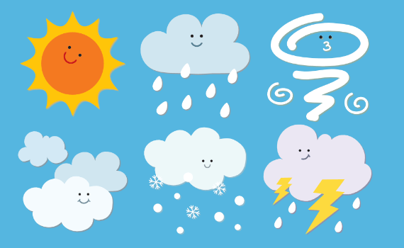
Weather

Natural Disasters

Experiments

Kid's Zone
Rain and Floods
- Rain Questions
- Flood Questions
- Radar Questions
- Flood Definitions
- Flood Safety
- Mudslide Safety
- Rain & Flood Activities
How does rain form?
Water droplets form from warm air. As the warm air rises in the sky it cools. Water vapor (invisible water in the air) always exists in our air. Warm air holds quite a bit of water. For example, in the summer it is usually very humid. When enough of these droplets collect together, we see them as clouds. If the clouds are big enough and have enough water droplets, the droplets bang together and form even bigger drops. When the drops get heavy, they fall because of gravity, and you see and feel rain.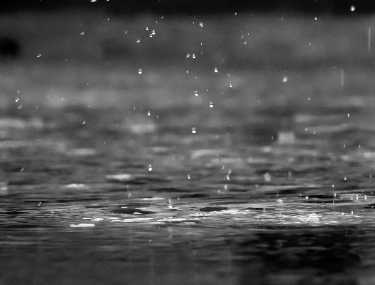
What causes rain?
When clouds develop or rain occurs, something is making the air rise. Several things can make this happen. Mountains, low-pressure areas, cold fronts, and even the jet stream.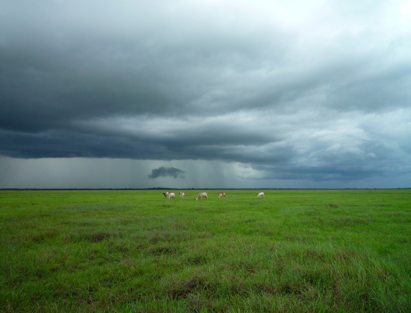
How big are raindrops?
Raindrops are much smaller than we think! They are actually smaller than a centimeter. Raindrops range from 1/100 inch (.0254 centimeter) to 1/4 inch (.635 centimeter) in diameter.
How fast do raindrops fall?
Not including wind-driven rain, raindrops fall between 7 and 18 miles per hour (3 and 8 meters per second) in still air. The range in speed depends on the the size of the raindrop. Air friction breaks up raindrops when they exceed 18 miles per hour.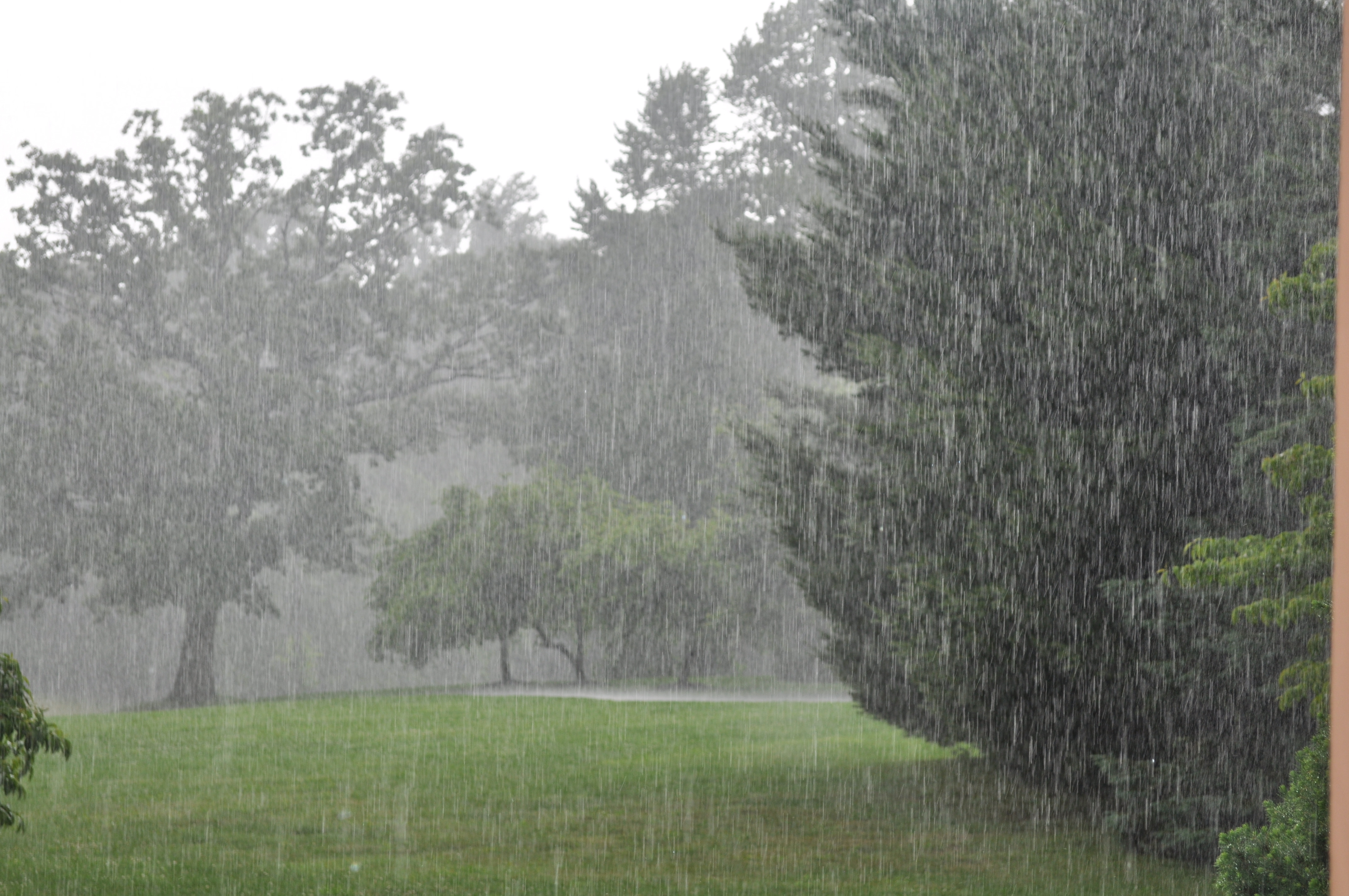
What is virga?
Virga is an observable streak of water drops or ice particles falling out of a cloud and evaporating before reaching the ground.
What is a monsoon?
A monsoon is a seasonal wind, found especially in Asia that reverses direction between summer and winter and often brings heavy rains. In the summer, a high pressure area lies over the Indian Ocean while a low exists over the Asian continent. The air masses move from the high pressure over the ocean to the low over the continent, bringing moisture-laden air to south Asia. During winter, the process is reversed and a low sits over the Indian Ocean while a high lies over the Tibetan plateau so air flows down the Himalaya and south to the ocean. The migration of trade winds and westerlies also contributes to the monsoons. Smaller monsoons take place in equatorial Africa, northern Australia, and, to a lesser extent, in the southwestern United States.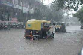
What are sinkholes?
Sinkholes are pits in the ground that form in areas where water gathers without external drainage. As water drains below ground, it can dissolve subterranean caverns, particularly in areas where the bedrock is made of water-soluble evaporate rocks such as salt or gypsum or of carbonate rocks such as limestone or dolomite. Most of the time, sinkholes form gradually. Occasionally, though, the collapse is sudden. Those sudden sinkholes are often the ones that open up and swallow cars, homes and streets.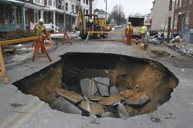
What are the different types of sinkholes?
Geologists divide sinkholes into three types. The first is a dissolution or solution sinkhole. In this type of sinkhole, there is little soil or vegetation over the limestone or other bedrock. Water from rain and runoff slowly trickles through crevices in the bedrock, dissolving it. As a result, a depression gradually forms. Dissolution sinkholes sometimes become ponds if the depression gets lined with debris, trapping water inside. Dissolution sinkholes happen slowly and are generally not dangerous, but one that becomes a pond can drain suddenly if water makes it through the protective bottom layer.
The second type of sinkhole is a cover-subsidence sinkhole. These sinkholes happen in areas where sand covers the bedrock. The sand filters down into openings in the rock, gradually causing the land surface to sink. Continued erosion increases the size of the depression. Like dissolution sinkholes, cover-subsidence sinkholes happen slowly.
The most dangerous type of sinkhole is a cover-collapse sinkhole. In these cases, the bedrock is covered by a layer of clay. Beneath this ground cover, however, water dissolves an underground cavern. Gradually, ground sediments begin to erode, or spall, into the cavern from the bottom. The ground continues to crumble from beneath until only a thin layer remains between the surface and the underground opening. When that layer collapses, the sinkhole opens up suddenly, swallowing any structures on top.
How do you measure rain?
Rain gauges provide the most accurate method of measuring rainfall at a single geographic point. To have operational value, the rain gauge report must be available in real time, and automated reporting networks are increasing. Real-time rain gauge networks are most useful for flash flood detection when WSR-88D rainfall estimates can be compared with the actual rain gauge values to determine the accuracy of the radar estimate.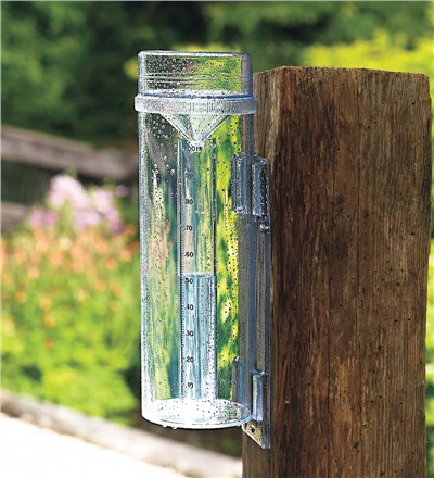
What is a flood?
Flooding is an overflowing of water onto land that is normally dry. Floods can happen during heavy rains, when ocean waves come on shore, when snow melts too fast, or when dams or levees break. Flooding may happen with only a few inches of water, or it may cover a house to the rooftop. They can occur quickly or over a long period and may last days, weeks, or longer. Floods are the most common and widespread of all weather-related natural disasters.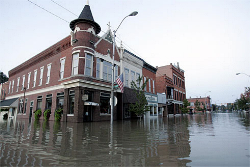
What is a flash flood?
Flash floods are the most dangerous kind of floods, because they combine the destructive power of a flood with incredible speed and unpredictability. Flash floods occur when excessive water fills normally dry creeks or river beds along with currently flowing creeks and rivers, causing rapid rises of water in a short amount of time. They can happen with little or no warning.
Where and when do floods occur?
Flooding occurs in every U.S. state and territory, and is a threat experienced anywhere in the world that receives rain. In the U.S. floods kill more people each year than tornadoes, hurricanes or lightning.
How much water is needed for your car to float away?
A mere 2 feet of water can float a large vehicle or even a bus. This is why you should never drive through flooded roads. Just 6 inches of rapidly moving flood water can knock a person down.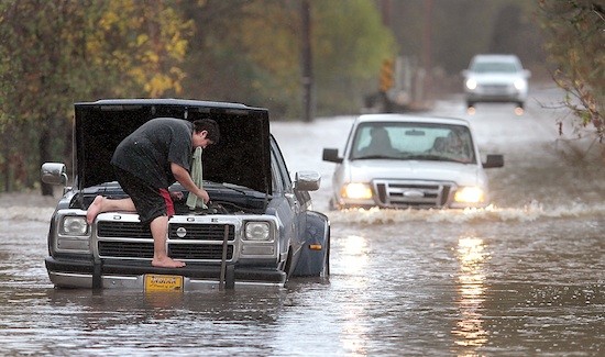
What areas are at risk from flash floods?
- Densely populated areas are at a high risk for flash floods. The construction of buildings, highways, driveways, and parking lots increases runoff by reducing the amount of rain absorbed by the ground. This runoff increases the flash flood potential. Sometimes, streams through cities and towns are routed underground into storm drains. During heavy rain, the storm drains can become overwhelmed and flood roads and buildings. Low spots, such as underpasses, underground parking garages, and basements can become death traps.
- Areas near rivers are at risk from flash floods. Embankments, known as levees, are often built along rivers and are used to prevent high water from flooding bordering land. In 1993, many levees failed along the Mississippi River, resulting in devastating flash floods. The city of New Orleans experienced massive devastating flooding days after Hurricane Katrina came onshore in 2005 due to the failure of levees designed to protect the city.
- Dam failures can send a sudden destructive wall of water downstream. In 1889 a dam break upstream from Johnstown, Pennsylvania, released a 30-40 foot wall of water that killed 2200 people within minutes.
- Mountains and steep hills produce rapid runoff, which causes streams to rise quickly. Rocks and clay soils do not allow much water to infiltrate the ground. Saturated soil also can lead rapidly to flash flooding. Vacationing or recreating along streams or rivers can be a risk if there are thunderstorms in the area. A creek only 6 inches deep in mountainous areas can swell to a 10-foot deep raging river in less than an hour if a thunderstorm lingers over an area for an extended period of time.
- Dry soil can produce flooding when very intense rainfall occurs. In the West, most canyons, small streams and dry arroyos are not easily recognizable as a source of danger. A wall of water 10-15 feet high can scour a canyon suddenly.
- Ice jams and snowmelt can help cause flash floods. A deep snowpack increases runoff produced by melting snow. Heavy spring rains falling on melting snowpack can produce disastrous flash flooding. Melting snowpack may also contribute to flash floods produced by ice jams on creeks and rivers. Thick layers of ice often form on streams and rivers during the winter. Melting snow and/or warm rain running into the streams may lift and break this ice, allowing large chunks of ice to jam against bridges or other structures. This causes the water to rapidly rise behind the ice jam. If the water is suddenly released, serious flash flooding could occur downstream. Huge chunks of ice can be pushed onto the shore and through houses and buildings.
How do I know how severe a flood will be?
Once a river reaches flood stage, the flood severity categories used by the National Weather Service include minor flooding, moderate flooding, and major flooding. Each category has a definition based on property damage and public threat.
- Minor Flooding—minimal or no property damage, but possibly some public threat or inconvenience
- Moderate Flooding—some inundation of structures and roads near streams. Some evacuations of people and/or transfer of property to higher elevations are necessary.
- Major Flooding—extensive inundation of structures and roads. Significant evacuations of people and/or transfer of property to higher elevations.
What were some of the worst floods in U.S. history?
The worst flood in U.S. history resulted from a dam break upstream from Johnstown, Pennsylvania, on May 31, 1889. Although ample warnings were given, they were disregarded by many townspeople, and 2,200 residents died.
Hurricane Katrina, a Category 4 hurricane along the eastern LA-western MS coastlines in August 2005, resulted in severe storm surge damage (maximum surge probably exceeded 25 feet) along the LA-MS-AL coasts, wind damage, and the failure of parts of the levee system in New Orleans. Inland effects included high winds and some flooding in the states of AL, MS, FL, TN, KY, IN, OH, and GA. Preliminary estimate of well over $100 billion in damage/costs and more than 1200 fatalities.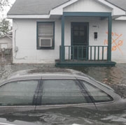
On February 26, 1972, the Buffalo Creek Dam located in southern West Virginia collapsed sending a black wave of water through one coal mining town after another, and killing more than 100 people. 4,000 people were left homeless.
On July 31, 1976, a storm in northern Colorado dumped a foot of rain into the Big Thompson Canyon producing a raging torrent of water 19 feet high and resulting in 145 deaths.
What is radar?
Radar is an electronic instrument, which determines the direction and distance of objects that reflect radio energy back to the radar site. It stands for Radio Detection and Ranging. This is what meteorologists use to see rain or snow.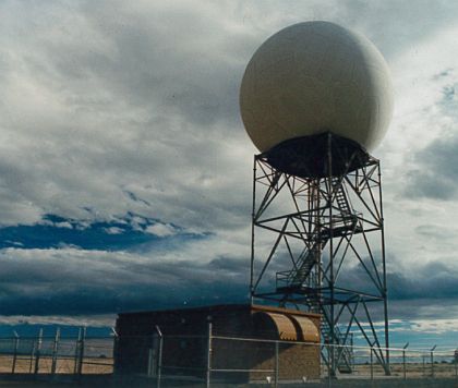
What is Doppler Radar?
Doppler Radar detects precipitation intensity, wind direction and speed, and provides estimates of hail size and rainfall amounts. Doppler Radar gives forecasters the capability of providing early detection of severe thunderstorms that may bring strong damaging winds, large hail, heavy rain, and possibly tornadoes. Combined with satellites, radar gives forecasters the ultimate tools to provide accurate forecasts and advanced severe weather warnings.
How does Doppler Radar work?
Doppler Radar gets its name from the Doppler Effect. Have you ever listened to a train whistle as it was coming toward you? You probably noticed that the pitch of the whistle changed as the train passed you and moved away. This change in the frequency of sound is called the Doppler Effect. Doppler Radar measures the changes in the frequency of the signal it receives to determine the wind.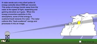
What is NEXRAD Radar?
The National Weather Service has installed a new type of Doppler Radar called NEXRAD Radar. NEXRAD stands for Next Generation Radar. This radar produces many different views of storms and rain that allows meteorologists to determine if a storm could be severe.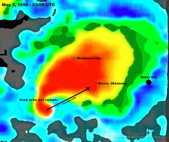
What are WSR-88D radars?
They graphically display detected precipitation on a map. Radar can show the location of the intense rainfall cores, and estimate the duration of rainfall. Radar can also track the evolution of storm systems over time. Forecasters are able to watch existing storm cells intensify, and see when new cells begin to develop. Animation of radar provides specific information on the movement of storm systems and helps in the assessment of the flash flood threat.
Currently, the NWS uses products developed for WSR-88D radars to aid in issuing flash flood statements, watches, or warnings. One product estimates one-hour precipitation accumulation to assess rainfall intensities for flash flood warnings, urban flood statements and special weather statements. Another product estimates accumulated rainfall, continuously updated, since the last one-hour break in precipitation. This product is used to locate flood potential over urban or rural areas, estimate total basin runoff and provide rainfall accumulations for the duration of the event.
FLOOD WATCH – means that an overflow of water from a river is possible for your area.
FLASH FLOOD WATCH – means that flash flooding is possible in or close to the watch area. Flash Flood Watches can be put into effect for as long as 12 hours, while heavy rains move into and across the area.
FLOOD WARNING – means flooding conditions are actually occurring in the warning area.
FLASH FLOOD WARNING – means that flash flooding is actually occurring in the warning area. A warning can also be issued as a result of torrential rains, a dam failure or snow thaw.
URBAN and SMALL STREAM ADVISORY– means flooding of small streams, streets and low-lying areas, such as railroad underpasses and urban storm drains is occurring.
Click Here to see if there are any active warnings in your area.
BEFORE A FLOOD: Have a disaster plan and prepare a disaster supplies kit for your home and car. Include a first aid kit, canned food, can opener, bottled water, battery-operated radio, flashlight, protective clothing and written instructions on how to turn off electricity, gas, and water.
DURING A FLOOD: Move to a safe area quickly. Move to higher ground, like the highest floor of your home. Avoid areas subject to sudden flooding like low spots and canyons. Avoid already flooded areas. If a flowing stream of water is above your ankles stop, turn around and go the other way. Do not attempt to drive through a flooded road. The depth of the water is not obvious and the road may be washed away. If your car stalls, leave it and seek higher ground. Rapidly rising water may engulf the car, pick it up and sweep it away. Kids should never play around high water, storm drains or viaducts. Be cautious at night, because its harder to see flood dangers. If told to evacuate, do so immediately.
AFTER THE FLOOD: Always, boil drinking water. Electrical equipment should be checked and dried before used.
Mudslides occur during periods of intense rainfall or rapid snowmelt. They usually start on steep hillsides, liquefy and accelerate down the hill. The debris flow ranges from watery mud to thick, rocky mud that can carry large items such as boulders, trees and cars. On average, mudslides cause 25 to 50 deaths each year. Always listen to the radio and television for the latest information and instructions for your area.
BEFORE INTENSE STORMS: Have a disaster plan. Become familiar with the land around you. Find out if you’re in a mudslide prone area.
DURING INTENSE STORMS: Stay awake and alert. If you live in mudslide prone areas, consider leaving if it safe to do so. If you can’t, go to the highest level of your home. Listen for unusual sounds that might indicate moving debris, such as trees cracking or boulders knocking each other. Be alert especially when driving. Watch the road for collapsed pavement, mud, fallen rocks and other indications of a possible debris flow.
DURING A MUDSLIDE: Quickly move out of the path of the mudslide. If you can’t escape, curl into a tight ball and protect your head.
AFTER A MUDSLIDE: Stay away from mudslide areas. Check for injured or trapped people near the mudslide, without directly entering the area. Watch out for flooding which can happen after a mudslide. Check the foundation of your home, chimney and surrounding land for damage.
Lesson Plan: Here is a great lesson plan on learning about precipitation. In this activity, kids will use a weather map to answer questions about precipitation falling across the country. Note: This is a PDF file, so you need to have Adobe Acrobat Reader.
Make It Rain Experiment: Here is a great experiment on making rain. In this experiment, kids learn about condensation.
What’s In The Rain Experiment: Here is an experiment that lets kids see what’s in the rain. It shows kids that there are particles in the air and when it rains they get to see them up close.
Make A Rain Gauge Experiment: Here is an experiment that allows a kids to make their very own rain gauge.
See A Raindrop Experiment: Here is an experiment that allows you to see a raindrop. In this experiment, kids will preserve raindrops, so they can measure to see how big they really are.
Water Cycle Experiment: Here is an experiment that teaches kids about our water cycle. This experiment shows what happens to the water in our creeks, streams, rivers, lakes and oceans.
The Doppler Effect Experiment: Here is an experiment that teaches kids what the Doppler Effect is. They can learn how the Doppler Effect works and why Doppler Radar is such as important tool in weather forecasting.
Suck An Egg Into A Bottle Experiment: Here is an experiment that shows how pressure is created in our atmosphere by sucking an egg in a bottle. This is a very cool experiment!
Make Your Own Barometer I Experiment: Here is an experiment that allows the kids to make a barometer.
Make Your Own Barometer II Experiment: Here is an experiment that allows the kids to make a barometer.
Create Evaporation Experiment: Here is an experiment that shows kids how evaporation takes place.
Science Fair Project Ideas: Here is a complete list of science fair project ideas. Discover the science behind the weather that impacts us every day.